
Yellowstone is the park every other national park is measured against. Set aside on 1 March 1872, it was the first national park in the world — 2.2 million acres across Wyoming, Montana and Idaho, with more than 10,000 hydrothermal features and more than 500 geysers, over half of all the geysers on Earth. The things to do in Yellowstone fall into five areas. The geyser basins sit in the south-west, the canyon in the east, the wildlife valleys in the north-east, the terraces in the north and the lake in the south-east, all joined by the 142-mile Grand Loop Road. Entry costs $35 per private vehicle for seven days, $30 for a motorcycle and $20 per person on foot or by bike. Since 1 January 2026, every non-US resident aged 16 and over also pays $100 per person on top of that, unless they enter with an annual pass — the America the Beautiful pass costs $80 a year for US residents and $250 for non-residents.
Yellowstone by area: the map that makes the park make sense
The Grand Loop Road is a figure-eight, 142 miles around, and each loop holds a different Yellowstone. The south-west loop is the geyser country: Old Faithful and the Upper Geyser Basin, then Grand Prismatic a few miles north. The east side is the canyon and the lake: the Grand Canyon of the Yellowstone, then Yellowstone Lake and West Thumb to the south. The north end is the wildlife country: Lamar Valley and Hayden Valley for the animals, Mammoth Hot Springs for the terraces. Norris Geyser Basin sits in the middle, between Mammoth and Madison, and it is worth a stop on the way through. Plan by area, not by sight — the driving between areas is the real cost of a Yellowstone day.
There are five entrances, and the one you choose decides your first day. The North Entrance at Gardiner, Montana, is the only one open to cars all year — it passes under the Roosevelt Arch, built in 1903, and Mammoth Hot Springs sits five miles inside it. The West Entrance at West Yellowstone is the busiest and the closest to the geyser basins. The Northeast Entrance at Cooke City opens straight into Lamar Valley, the East Entrance from Cody crosses Sylvan Pass to the lake, and the South Entrance comes up through Grand Teton from Jackson. The other four close to regular cars in winter.
Old Faithful and the Upper Geyser Basin
Old Faithful is the one sight nobody skips, and it earns the crowd. It erupts every 60 to 110 minutes, throwing 3,700 to 8,400 gallons of boiling water 106 to 184 feet into the air, and each eruption lasts one and a half to five minutes. It was named by the 1870 Washburn Expedition for the regularity of its eruptions. Check the prediction board at the visitor centre, or the NPS app — rangers predict each eruption from the length of the last one, and about 90 percent land within ten minutes either way.
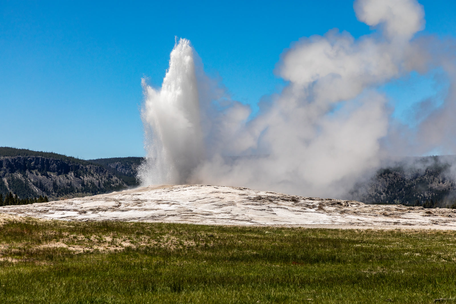
Old Faithful is only the front door. The Upper Geyser Basin around it holds more than 150 geysers in about a square mile — the densest concentration of geysers on Earth — and the boardwalk loop past them is the best two hours in the park. Grand Geyser is the tallest predictable geyser in the world, reaching up to 200 feet, but it only goes off every six to fifteen hours. Daisy Geyser erupts every two to four hours in a diagonal jet up to 75 feet, Riverside Geyser arcs its water over the Firehole River, and Castle Geyser’s cone has been building for thousands of years. Walk the Geyser Hill loop, about 1.3 miles round trip, then keep going to Morning Glory Pool, about a mile and a half each way — a deep blue spring ringed in orange and yellow. Biscuit Basin, just north of Old Faithful, has been closed since a hydrothermal explosion destroyed its boardwalk on 23 July 2024, and was still closed at the time of writing.
Grand Prismatic Spring and the Midway Geyser Basin
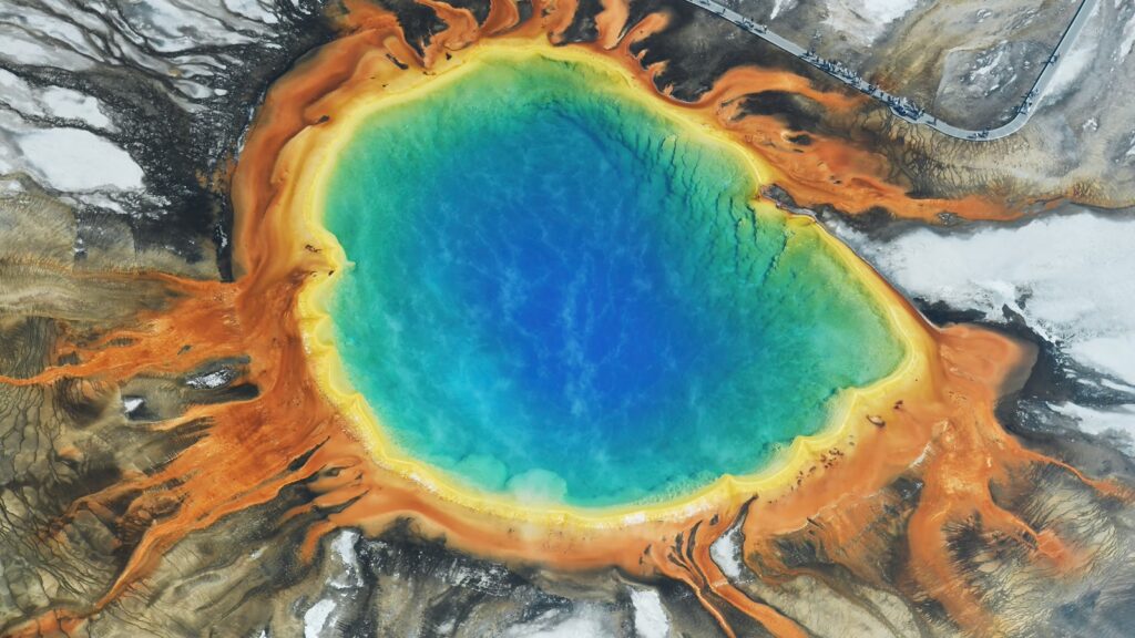
Grand Prismatic Spring is the largest hot spring in the United States and the third largest in the world — about 370 feet across and more than 120 feet deep — and it is the most photographed thing in Yellowstone after Old Faithful. The colours are the point: a deep blue centre, ringed in green, yellow, orange and red by heat-loving microbes that live at different temperatures in the runoff. From the boardwalk you look almost straight down into it, so the full colour pattern only shows from above. The Midway boardwalk is under a mile long, and the Excelsior Geyser crater sits beside the spring, a huge empty bowl that used to erupt and now steams.
For the view that makes the spring make sense, drive one mile south to the Fairy Falls Trailhead and walk the Grand Prismatic Overlook Trail: 1.2 miles round trip with a 105-foot climb to a platform above the spring. The same trail continues to Fairy Falls, a 197-foot waterfall about five miles round trip from the car park. The Fairy Falls trail runs through a Bear Management Area and is closed from March until Memorial Day weekend, and both car parks fill up in summer — go first thing in the morning or late in the afternoon.
The Grand Canyon of the Yellowstone
The Yellowstone River drops over two waterfalls and cuts a gorge about twenty miles long, more than a thousand feet deep and 1,500 to 4,000 feet wide, its walls stained yellow, orange and pink by hot water and gas rising through the rock. The Lower Falls drops 308 feet in a single plunge — nearly twice the height of Niagara Falls, and the tallest waterfall in the park — and the Upper Falls drops 109 feet just upstream. The canyon bends between the two falls, so there is no place where you can see them both at once.
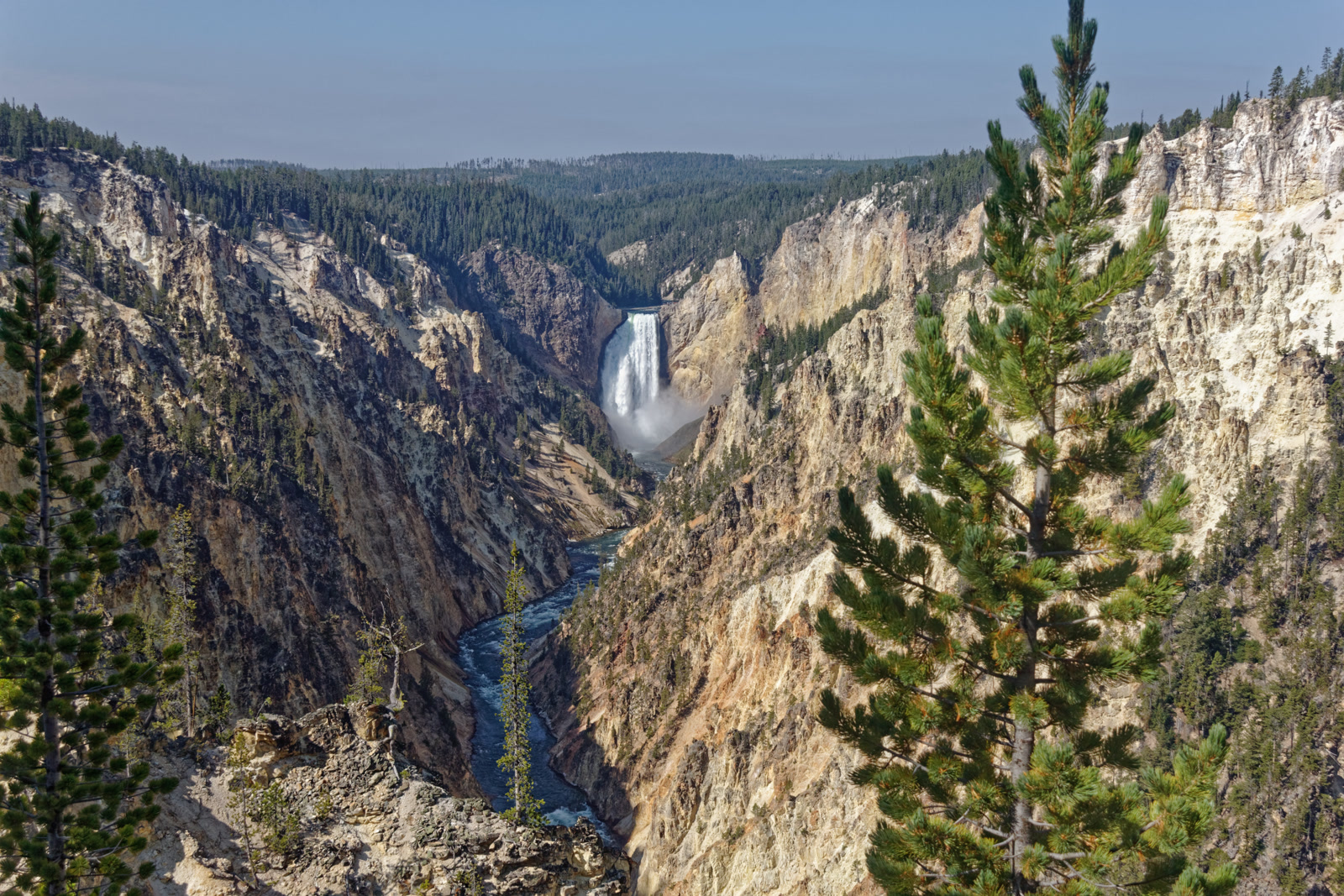
Artist Point, on the South Rim drive, is the most photographed view in the park: the falls framed by the yellow canyon. The North Rim drive gives you the closer views: the Brink of the Upper Falls, Lookout Point, and the Brink of the Lower Falls trail, a short, steep walk to a viewpoint right beside the 308-foot drop. Uncle Tom’s Trail, which used to descend toward the base of the falls, was closed for good in 2019. Give the canyon half a day, and go in the morning, when the sun lights the falls.
Lamar Valley and Hayden Valley: the wildlife mornings
Lamar Valley is the best place in the world to watch wild wolves, and the only way to do it is to be there at dawn. The valley runs along the Northeast Entrance Road between Tower-Roosevelt Junction and Cooke City, wide open grassland, and the animals are out in the low light: bison, elk, pronghorn, coyotes, grizzly bears and wolves. Wolves were wiped out of the park by 1926, then brought back in 1995 — fourteen from Alberta released in the Lamar Valley, seventeen more in 1996 — and their descendants still range the valley today. At the end of 2025 the park counted 84 wolves in eight packs. The pullouts near Slough Creek are the most reliable place to stand, and the regulars with spotting scopes will usually point you at the right hillside. A wolf is never guaranteed, and most sightings are half a mile to two miles away, so bring binoculars or a scope — without one you will be watching dots. The road through Lamar stays open to cars all year.
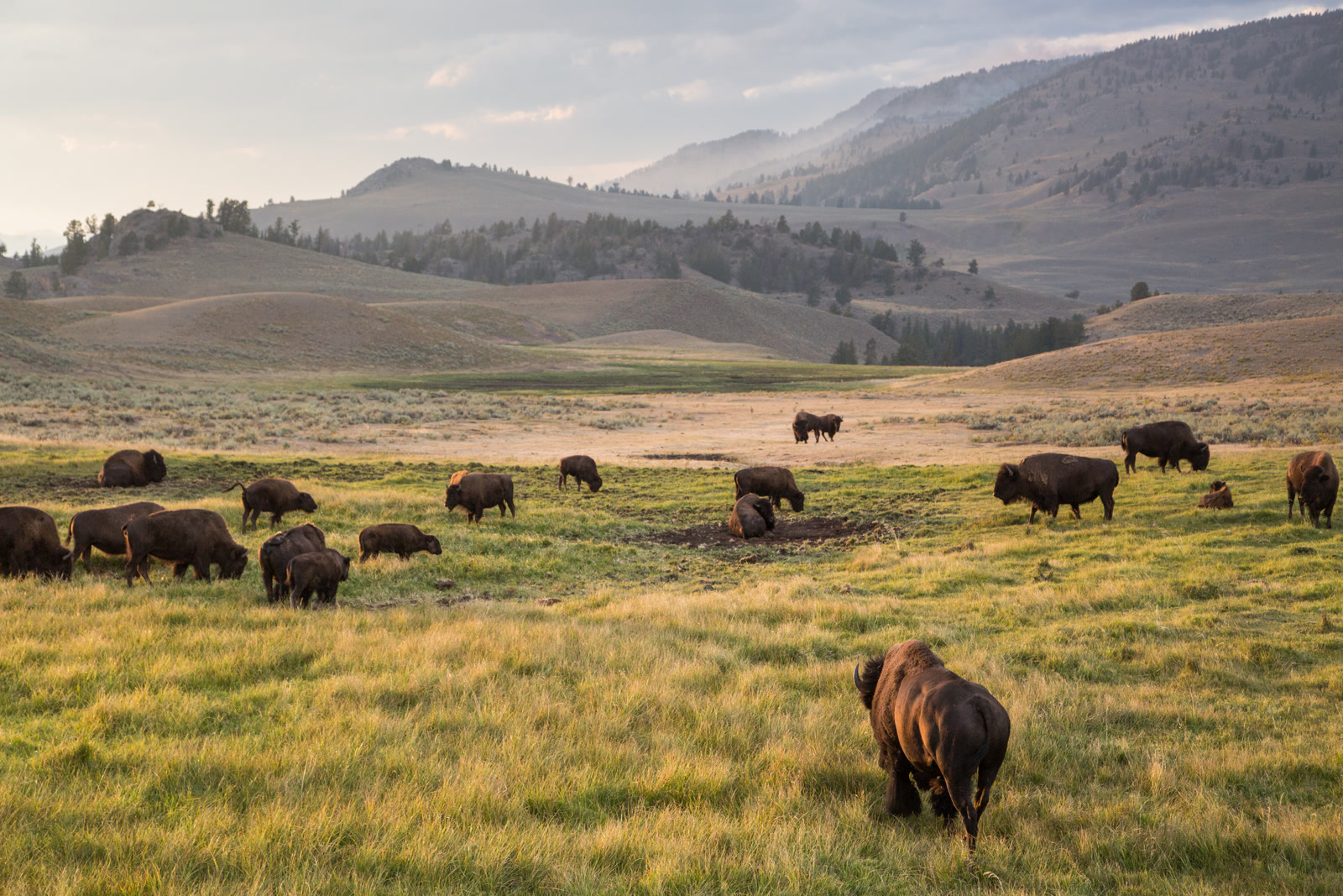
Hayden Valley, between Canyon and the lake, is the second wildlife morning. It is bison country first — herds of hundreds spread across the valley floor at dawn, with grizzly bears working the riverbanks in spring and autumn. The Mud Volcano area sits at its northern end, with the Dragon’s Mouth Spring bubbling and hissing beside the road. Be there before sunrise, stay until the light goes flat, and pull fully off the road at a bison jam instead of stopping in the lane — the best mornings are the ones where you give the valley two hours instead of twenty minutes.
Mammoth Hot Springs and the north end
Mammoth Hot Springs looks like nothing else in Yellowstone, because it is built from a different rock. Hot water rises through limestone and lays down travertine — more than two tons a day — building white, stepped terraces that grow, shift and dry out over months and years. The water at the vents is around 170°F, and the orange, yellow and green streaks on the white stone are heat-loving microbes in the runoff. Minerva Terrace is the famous one, a wide fan of travertine that has gone through long dry periods and sudden revivals, and Liberty Cap, a 37-foot cone left by a spring that went dry, stands at the north end of the boardwalk. Walk the Lower Terraces on foot, then drive the Upper Terrace Drive for Canary Spring and Orange Spring Mound. The terraces change with the water, and a terrace that was white and flowing last year can be dry and grey this year.
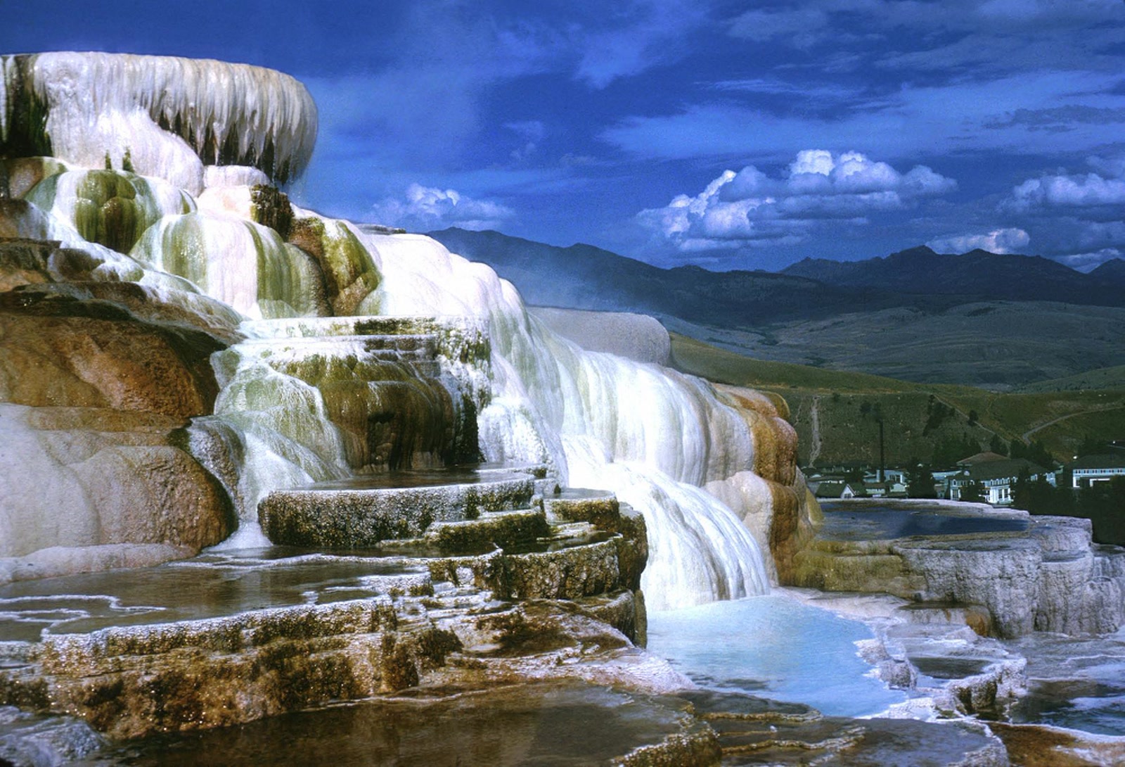
Below the terraces sits Mammoth village: Fort Yellowstone’s red-roofed stone buildings from the Army era, the Albright Visitor Center, a hotel, a campground and a post office — and a lawn the elk treat as their own. The herd grazes the parade ground most evenings, and in the autumn rut the rangers keep visitors back. Mammoth is five miles south of the North Entrance, and it is the only developed area open by car all year. On the way south, stop at Norris Geyser Basin, home to Steamboat Geyser, the largest active geyser in the world. Tower Fall, near Tower-Roosevelt Junction on the road to Lamar, is the other north-end stop — a roadside waterfall framed by volcanic pinnacles.
Yellowstone Lake and West Thumb
Yellowstone Lake sits at 7,733 feet, the largest high-elevation lake in North America: roughly twenty miles long and fourteen miles wide, with 132 square miles of water and 141 miles of shoreline. It freezes over every winter, usually in late December or early January, and thaws in late May or early June. The water stays near 41°F even in midsummer, so nobody swims in it. The Yellowstone River leaves the lake at Fishing Bridge, its only outlet, on its way north to the canyon.
West Thumb Geyser Basin, on the lake’s western shore near Grant Village, is the one geyser basin that sits right on the water. Steam rises from springs at the lake’s edge, and the boardwalk loop, about six-tenths of a mile and thirty to forty-five minutes, passes Abyss Pool, one of the deepest hot springs in the park, and Black Pool, which turned vivid blue when its bacteria died in a temperature shift in 1991. Fishing Cone is a geyser vent that rises straight out of the lake, where early visitors used to catch a trout and cook it in the boiling pool on the end of the line — long since prohibited, and the cone is fenced off.
Hikes, lodges and the practical rules that keep you safe
The Geyser Hill loop in the Upper Geyser Basin is about 1.3 miles round trip from the visitor centre. The Grand Prismatic Overlook Trail is 1.2 miles round trip with a 105-foot climb. The West Thumb boardwalk loop is about six-tenths of a mile. The Brink of the Lower Falls trail is short and steep, and the climb back up is the workout. Fairy Falls is about five miles round trip, flat through lodgepole forest to a 197-foot waterfall. Carry bear spray on any trail and know how to use it — the whole park is grizzly and black bear country, from the backcountry to the Old Faithful car park.
The lodges inside the park are part of the experience, and they book up months ahead. The Old Faithful Inn, built in 1903–1904, is considered the largest log structure in the world — its seven-storey lobby is worth a look even if you are not staying there. The Lake Yellowstone Hotel, Canyon Lodge, Grant Village Lodge and Mammoth Hot Springs Hotel are the other in-park options, and the campgrounds book ahead too. Staying inside the park is the single best move for wildlife mornings: you are already in the valleys at dawn.
The practical rules are short, and they matter more here than in most parks. Gas is at six stations — Canyon Village, Fishing Bridge, Grant Village, Mammoth Hot Springs, Old Faithful and Tower Junction, all with 24-hour card fueling — and nothing at Madison, Norris or West Thumb, so fill up before you enter. Cell service is patchy or absent across much of the park, so download the NPS app’s offline map before you arrive. Keep at least 100 yards from bears, wolves and cougars and at least 25 yards from bison, elk and every other animal — bison injure more visitors in Yellowstone than bears do. Stay on the boardwalks in every thermal area: the ground is a thin crust over scalding water, and more than twenty people have died from burns after leaving the marked paths. And remember the altitude: most of the park sits between 7,000 and 8,000 feet, so drink water and pace the first day.
FAQ
How much does it cost to get into Yellowstone in 2026?
$35 per private vehicle for seven days, $30 for a motorcycle and $20 per person on foot or by bike. Since 1 January 2026, every non-US resident aged 16 and over also pays $100 per person on top of the entrance fee, unless they hold an annual pass — $80 a year for US residents, $250 for non-residents. There is no timed entry or reservation.
How often does Old Faithful erupt?
Roughly every 60 to 110 minutes, with the current median around 102 minutes. Each eruption lasts one and a half to five minutes and reaches 106 to 184 feet. Rangers predict the next one from the last — check the board at the visitor centre or the NPS app.
Can I see wolves in Lamar Valley?
You can, but it is never guaranteed. Wolves are most active at dawn and dusk, and the pullouts near Slough Creek are the most reliable place to stand. Bring binoculars or a spotting scope: most sightings are half a mile to two miles away. Winter and spring are best, and the road through Lamar stays open to cars all year.
Is one day enough for Yellowstone?
No. One day covers one area properly — the geyser basins, or the canyon and the lake — and the driving between areas eats the rest. Three days is the honest minimum: one for the geysers, one for the canyon and the lake, and one for the wildlife valleys and Mammoth. If you have more than a day, our Yellowstone Itinerary turns these areas into a day-by-day plan.
Do I need a car in Yellowstone?
Yes. There is no public transport inside the park, and the sights are spread across a 142-mile loop road.
The Short Version
The things to do in Yellowstone fall into five areas — take them one at a time. Start in the south-west with Old Faithful and the Upper Geyser Basin, then Grand Prismatic Spring and the Midway boardwalk. Take the east side for the Grand Canyon of the Yellowstone and Artist Point, then Yellowstone Lake and the West Thumb boardwalk. Give the north end a dawn: Lamar Valley for the wolves and bison, Hayden Valley for the herds, and Mammoth Hot Springs for the terraces. Pay $35 at the gate for seven days — plus $100 per non-US resident aged 16 and over since January 2026, unless you hold an annual pass — stay on the boardwalks, keep your distance from the animals, and be in the valleys before sunrise. Three days is the minimum — our Yellowstone Itinerary arranges the areas as a day plan.