
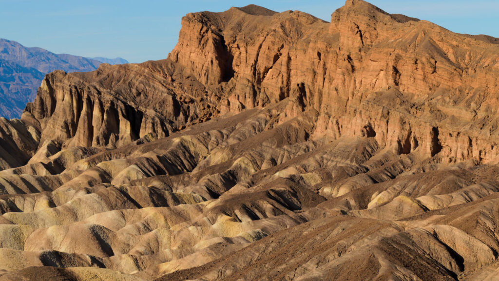
Death Valley is the closest national park to Las Vegas, and the las vegas to death valley day trip is one of the best escapes from the Strip — if you do it right. The drive is about 120 miles and two hours each way, and five great sights fit one long day. But in summer this is the hottest place on Earth, and the Park Service itself tells you not to hike in the valley when it is hot. So this guide is built for mid-October through April. Leave by 5 or 6 in the morning, and you will watch the sun come up over the badlands, stand 282 feet below sea level by late morning, and be back in time for dinner.
How far is Death Valley from Las Vegas, really?
Furnace Creek, the developed heart of Death Valley National Park, sits about 120 miles west of the Las Vegas Strip, and the drive takes roughly two hours on the shortest route. The park boundary is closer, about 110 miles, but Furnace Creek holds the visitor center, gas and water.
The shortest route runs through Pahrump and Death Valley Junction. A longer alternative runs north on US-95 to Beatty, then in through the northeast entrance — about 145 miles, but it passes Rhyolite, a genuine ghost town, a good way home.
One thing to settle before you go: there is no public transport to Death Valley and no shuttle inside the park. A car is the only way in, and every road on this trip is paved. Do not let a navigation app talk you onto an unpaved shortcut — the Park Service is blunt about it: stay on the paved roads.
The route that works
Learn the route before you leave, because cell service dies not long after Pahrump. Download offline maps the night before.
From the Strip, take Interstate 15 south to Nevada Highway 160 west — Blue Diamond Road — toward Pahrump, about 60 miles away and the last real town on the way. Fill the tank there, buy water and ice, and use the restroom. Then turn left on Bell Vista Road, about three miles north of Highway 372, and follow it about 30 miles to Death Valley Junction. Turn right on California Highway 127, then almost immediately left on California Highway 190, and drive the final 30 miles to the Furnace Creek Visitor Center.
That is 120 miles and two hours, paved the whole way. Leave by 5 or 6 a.m. and you will reach Dante’s View as the light turns the valley gold. Check the Park Service alerts page the night before: as of November 1, 2026, all the main paved roads on this route were open, but Scotty’s Castle was closed for flood recovery with no reopening date, and Titus Canyon Road was closed for repairs until May 2027. Desert roads change fast after storms.
What to see in one day: the 5 stops that fit
Five stops fit one day, in this order: Dante’s View at sunrise, Zabriskie Point, Badwater Basin, Artists Drive, and the Mesquite Flat Sand Dunes at sunset, with Furnace Creek in the middle for water. Everything sits within about 25 miles of Furnace Creek.
| Time | Stop | Why now |
|---|---|---|
| 5:00 a.m. | Leave Las Vegas | Beat traffic and heat |
| 7:00 a.m. | Dante’s View | Sunrise over the valley |
| 8:30 a.m. | Zabriskie Point | Morning light |
| 9:30 a.m. | Furnace Creek | Water and restrooms |
| 10:30 a.m. | Badwater Basin | Before the midday glare |
| 1:00 p.m. | Artists Drive | Afternoon colour |
| 4:30 p.m. | Mesquite Flat Sand Dunes | Sunset walk |
| 6:00 p.m. | Drive back | Home by 9–10 p.m. |
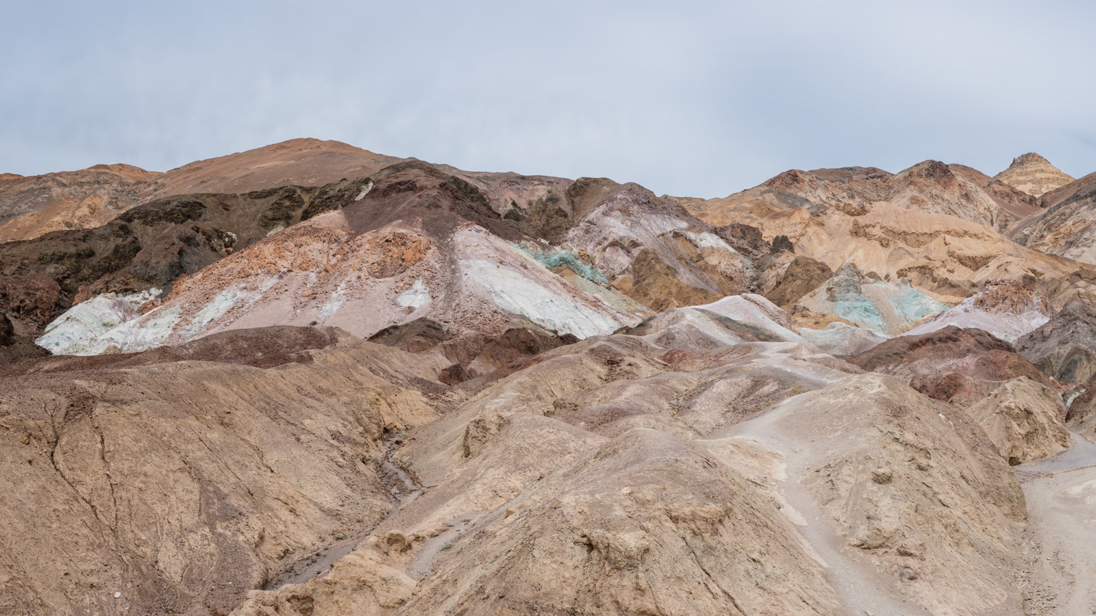
Artists Drive is the park’s most popular scenic drive: a nine-mile, one-way paved road through multicoloured, eroded hills, starting off Badwater Road 8.5 miles south of the Highway 190 junction. It takes 25 to 45 minutes with stops, and vehicles over 25 feet are not allowed. Artist’s Palette, about five miles in, is the highlight — a hillside streaked pink, white and green from volcanic deposits, visible from the parking area with no hike.
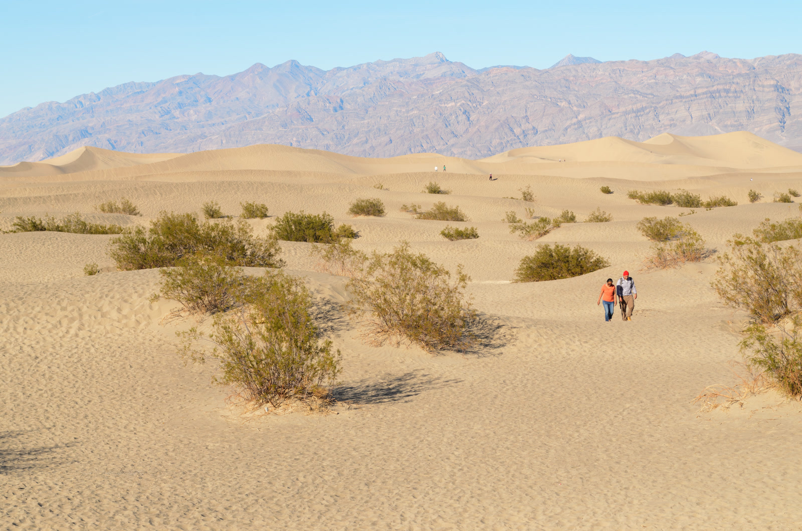
The dunes are the sunset stop. The Mesquite Flat Sand Dunes cover about 14 square miles just outside Stovepipe Wells Village, 23 miles northwest of Furnace Creek on Highway 190, and they are the most accessible dunes in the park. There is no formal trail; the tallest dune is about 100 feet high, a two-mile round trip. In summer, do this stop first thing in the morning or skip it; the sand is brutally hot by midday.
Badwater Basin: the lowest point in North America
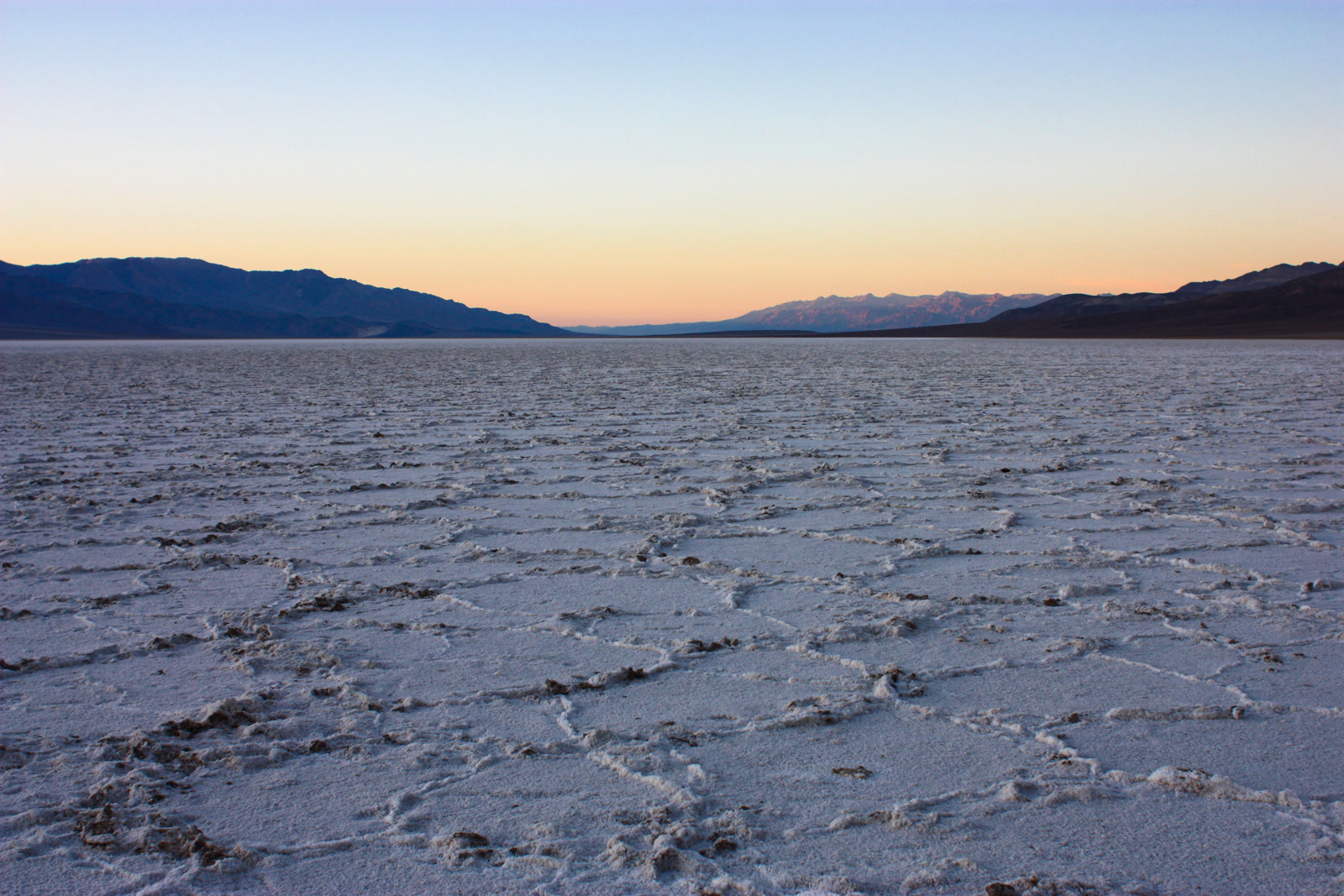
Badwater Basin is the lowest point in North America at 282 feet below sea level. The salt flats cover nearly 200 square miles, and a short quarter-mile walk from the parking area brings you onto the salt polygons — the cracked white hexagons on every Death Valley postcard. Across the valley, Telescope Peak rises to 11,049 feet.
Badwater Basin sits on Badwater Road, 17 miles — about 30 minutes — south of Furnace Creek. The walk from the parking area is flat and easy. Go in the morning, before the midday glare turns the white salt into a mirror. Take the Park Service warning seriously: no hiking after 10 a.m. in summer, including the short walk onto the salt.
Zabriskie Point and Dante’s View
These two viewpoints are the reason to leave before dawn. Zabriskie Point is close and easy; Dante’s View is high and vast.
Zabriskie Point sits about four or five miles east of Furnace Creek on Highway 190, and a quarter-mile paved walk climbs to the overlook. What you see is a maze of eroded badlands in gold, brown and rust, with Manly Beacon rising above them. The point is named for Christian Brevoort Zabriskie of the Pacific Coast Borax Company. On a day trip, catch it in the morning light.
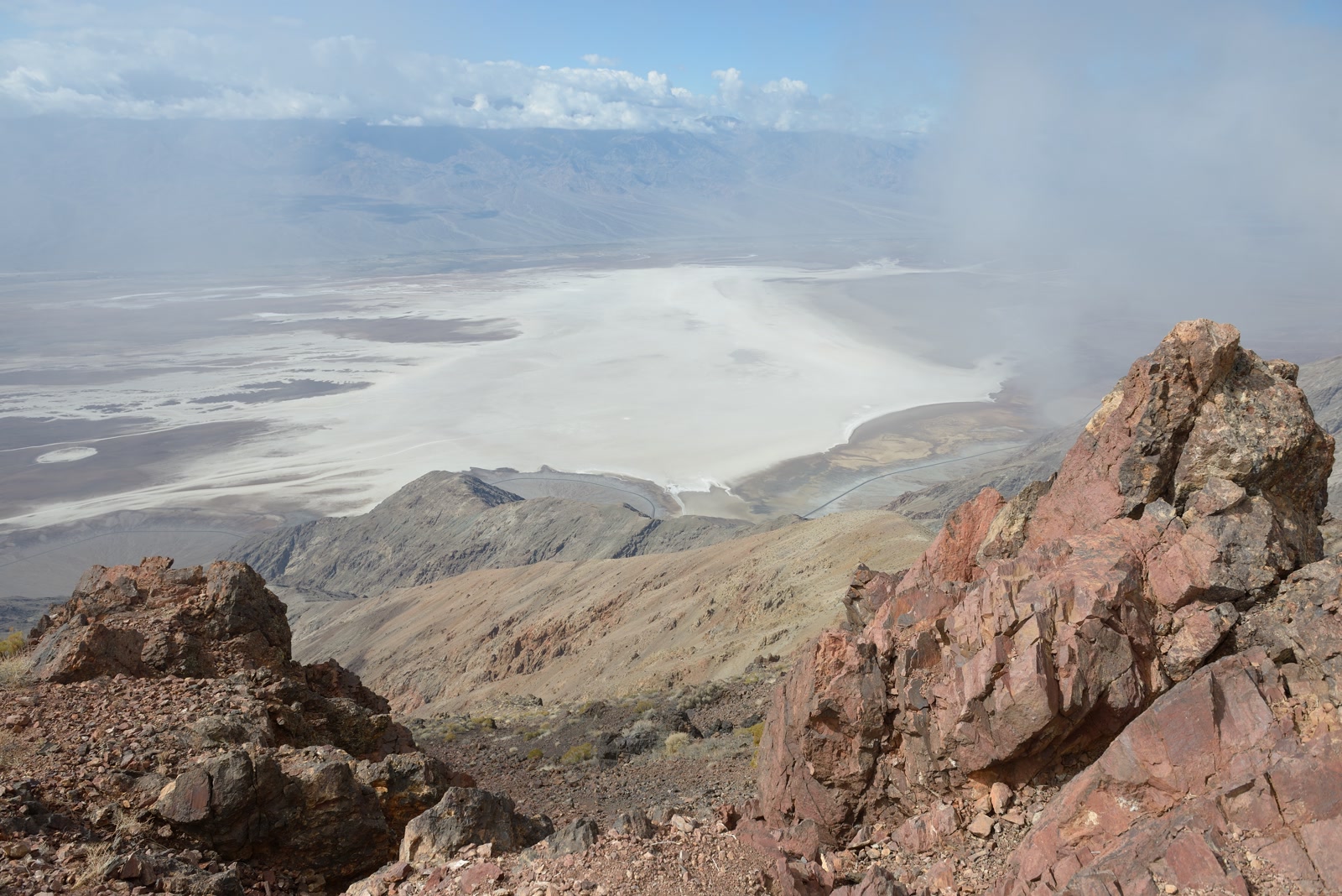
Dante’s View is the opposite experience: a mountaintop terrace at 5,475 feet on the crest of the Black Mountains, about 25 miles and 45 minutes from Furnace Creek, reached by a 13.2-mile paved road off Highway 190. Vehicles over 25 feet are prohibited. From the top, Badwater Basin lies almost a vertical mile below you, the Panamint Range fills the western horizon, and on a clear day you can pick out Mount Whitney, the highest point in the contiguous United States. The elevation difference visible from this one spot — 11,049-foot Telescope Peak down to Badwater at minus 282 feet — is 11,331 feet, the greatest topographic relief in the lower 48 states. Go at sunrise.
Furnace Creek: the only real base
Furnace Creek is the one place in Death Valley with real services, and on a day trip it is your base. The Visitor Center is open daily, 8 a.m. to 5 p.m. — pay the entrance fee there, pick up a map, and ask a ranger about conditions.
Around the visitor center are a gas station, a general store, restaurants, and the Oasis at Death Valley, the park’s lodge. Water is available here, at Stovepipe Wells and at Panamint Springs — and nowhere else in the park, so fill every bottle here. Death Valley is 3.4 million acres, the largest national park in the contiguous United States, and Furnace Creek is the one dot on it with people, fuel and water.
The entrance fee is $30 per private vehicle, good for seven days with unlimited re-entry, covering everyone in the car. Motorcycles pay $25, and people on foot or by bicycle pay $15 each. The park’s own annual pass is $55, and the America the Beautiful annual pass at $80 covers it too. The park is cashless — bring a card. Unlike some other parks, Death Valley charges no extra fee for non-US residents, so $30 is the price for everyone.
The heat warning: when NOT to go
Death Valley is the hottest place on Earth. The highest air temperature ever reliably recorded anywhere — 134 degrees Fahrenheit — was set here on July 10, 1913. In the summer of 2024 the park averaged a high of 117.3 degrees, with 37 days over 120 degrees and nine straight days when it never dipped below 100, even at night.
The Park Service’s advice is blunt: do not hike in the valley or at lower elevations when it is hot. Drink at least one gallon of water per person per day. Eat salty food or drink electrolytes — sweating in this dry air steals salt as fast as water. If you feel dizzy or nauseous, get out of the sun and drink. Heat illness here can be severe, and people die in Death Valley nearly every summer.
That is why this guide is built for mid-October through April. If you do go in summer, treat the car as the activity: stay on paved roads, keep stops short, stay close to air conditioning, and do not hike after 10 a.m. If your car breaks down, stay with it — a breakdown in 120-degree heat is a life-threatening emergency, and cell service does not exist across most of the park. Off-road driving is illegal here and can bring a fine of at least $750.
What to pack and where to get gas
Bring a gallon of water per person per day, plus extra in the car. Bring salty snacks or electrolyte drinks. Download offline maps before you leave Las Vegas — navigation apps have sent visitors down unpaved roads in this park, and once you are past Pahrump the signal is gone.
Gas is the other thing to plan. Fill up in Pahrump on the way in — it is the last reliably cheap gas before the park. On the northern route home, Beatty has gas too. Inside the park, stations at Furnace Creek and Stovepipe Wells are few and priced well above Nevada prices. There is no gas at Dante’s View, Badwater or the dunes, so do not leave Furnace Creek with less than half a tank. EV drivers: charge fully in Las Vegas — power outages can take the in-park chargers down.
Death Valley or Zion: which day trip?
Zion is the other obvious day trip from Las Vegas, but it is a different kind of day. Death Valley is about 120 miles and two hours away, with no shuttle, no time-zone change, no reservations and a $30 fee. Zion is about 160 miles and two and a half to three hours away on Interstate 15 north, through the Virgin River Gorge to Springdale, Utah. Utah is one hour ahead of Las Vegas, so you lose an hour on the way there. From March through November, private cars are barred from the Zion Canyon Scenic Drive between 6 a.m. and 7 p.m., so you ride the free shuttle, and the fee is $35 per vehicle.
Death Valley is the better single day — shorter drive, your own car, five sights in one loop. Zion is the better two-day trip — the canyon deserves a full day of hiking, and the shuttle, the crowds and the time-zone change eat too much of a single day. One free day: Death Valley. Two days: Zion.
FAQ
How far is Death Valley from Las Vegas?
Furnace Creek, the heart of the park, is about 120 miles from the Strip — roughly two hours on the shortest route, west on Nevada Highway 160 through Pahrump, then Bell Vista Road and California Highway 190 into the park.
Can you do Death Valley in one day from Las Vegas?
Yes — leave by 5 or 6 a.m., see all five stops, and be back by 9 or 10 p.m. Go between mid-October and April; in summer the heat makes a full day dangerous.
What is the best time of year to visit Death Valley?
Mid-October through April. Avoid June–August, when temperatures routinely pass 120 degrees.
How much is the entrance fee?
$30 per private vehicle, valid seven days with unlimited re-entry, covering everyone in the car. Motorcycles pay $25, people on foot or by bicycle pay $15 each, and the park is cashless — bring a card. No extra fee for non-US residents.
Is there gas in Death Valley?
Yes, at Furnace Creek and Stovepipe Wells, but it costs more than in Nevada. Fill up in Pahrump on the way in, and do not leave Furnace Creek with less than half a tank.
Is Death Valley or Zion the better day trip from Las Vegas?
Death Valley for one day; Zion for two. Zion’s canyon, shuttle and time-zone change need more time than a single day allows.
The Short Version
The las vegas to death valley day trip works — 120 miles, about two hours each way, five great stops in one loop. Leave Las Vegas by 5 a.m., take Highway 160 through Pahrump to Furnace Creek, and do Dante’s View at sunrise, Zabriskie Point, Badwater Basin, Artists Drive and the dunes at sunset. The fee is $30 per vehicle for seven days. Go between mid-October and April, fill up in Pahrump, carry a gallon of water per person, and check the Park Service alerts page the night before. In summer, the heat is genuinely dangerous — the car, not the trail, is the plan.